
Drones in Building Surveying
Overview
Over the last 10 years, drones have been increasingly adopted for a variety of purposes within the construction industry. Although their use is far from standard, there are significant examples of where benefits have been gained, particularly for large and complex projects.
Drone footage can be utilised in a number of ways during the construction phase of a project. From understanding the layout of a site and what earthworks are needed, to monitoring progress and site activity through the construction programme and onwards to identifying problems and improving safety briefings.
This is particularly true for large projects such as highways, flood works, power plants, solar arrays, data and logistic centres etc. where the footprint of the site is large, but the structures may not be particularly tall.
How can Drones be of use beyond the construction phase to building surveyors?
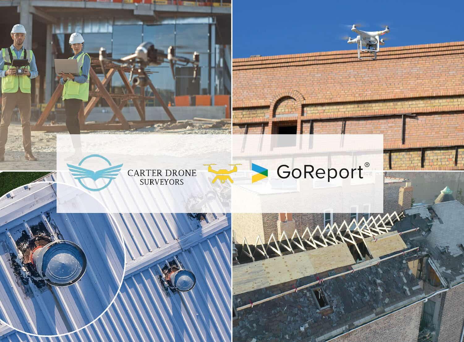
For the building surveyor, there are obviously tremendous advantages in utilising drones to access hard to reach areas and gather information where other methods are either expensive or create additional risk or safety issues. Where previously scaffolding, mobile elevated platforms or other specialist rope access inspections may be required for roofs, building façade or cladding, a drone is obviously going to be more time efficient and gather detailed information for thorough review in a systematic way. Schedules of condition (SOC), planned preventative maintenance (PPM), defect investigation etc. may all have issues with fully accessing parts of the building and a drone can provide a suitable solution to ensure all aspects are fully considered on behalf of the client.
Alex Carter of Carter Drone Surveyors, an RICS chartered building surveying practice offering a wide range of residential and commercial surveying services, recognised the benefits of adopting Drone expertise as part of their core offering. Early implementation of drone technology has given them a unique insight into the future opportunities and challenges.
“It was clear to us several years ago that drone technology was advancing rapidly and would provide us with an invaluable tool as building surveyors.” says Alex Carter, founder of Carter Drone Surveyors.
“However, we also found hesitation in the industry as the use of Drones was seen as a luxury extra and a separate deliverable for a survey, rather than a very valuable data source that supports our investigations and ability to provide clear guidance and advice to our clients.”
Alex recognised that part of the issue was the need to contract an additional 3rd party to provide and fly the drones. This contributed to the perception of it being a luxury item rather than a key part of the surveyor’s toolkit and so he took the step of developing the Carter Drone Surveyors business with drone capability embedded in their service offering where appropriate.
“Naturally, like any tool, drones should only be used where appropriate and where they can provide supporting information for the particular survey required. We utilise drones for detailed roof and high-level inspections as you might expect but also as part of a wider schedule of condition (SOC), planned preventative maintenance (PPM) assessment through to residential surveys. We can do this as the use of a drone is considered as part of our everyday toolkit.”
Can any surveyor start using a drone?
The availability of relatively inexpensive drones and their growing use in business contexts might give rise to an impression that anyone can buy a drone and start using it in their business. However, this is far from the case as Alex explains.
“There are a wide range of factors to consider when offering a drone service. First and foremost, training and qualification is essential to be able to fly a drone safely in the typical building environments that a surveyor is likely to be operating in, such as built up or where people are reasonably expected to be present. Risk Assessment and safety consideration are paramount when planning a flight. The building surveyor is obviously best placed to control and direct where the drone is flying. While gathering information for the survey and operating the drone, they must be clearly focused on controlling the drones flight safely.” Alex himself has a General VLOS certificate and an operational authorisation from the Civil Aviation Authority which enables him to operate in this specific category.
In addition, not all drones are equal and there are specific considerations in terms of the appropriate size and weight of a drone for stability in varying wind speeds, quality of camera and suitability of other features such as thermal imaging and how to interpret this data accurately.
What do you do with the outputs of a drone?
“When considering drone usage, you have to be knowledgeable and realistic about whether a drone will benefit the survey and which type of drone is most appropriate to the situation. Most clients are unlikely to be excited about the use of drones versus a camera or other method to collect information, the key outcome for a client is our report and findings. We analyse the drone footage post flight alongside our other digitally captured information to consider and finally produce our report. We have invested in GoReport for our digital data collection and reporting for all of the different surveys we deliver. The GoReport solution allows us to import and easily annotate our high-resolution drone photograph stills and include them as part of the production of the final professional report.
As the drone footage itself is analysed and the important aspects considered and translated into our reports, there isn’t often value in transmitting the raw footage to the client. In part, this is because file sizes of the drone footage are often very large and require an external hard drive to share. However, we do preserve them, as new value can subsequently be generated from the captures, such as advising contractors appointed to remedy particular issues or for future re-surveys to compare changes over time.”
What does the future hold for drone usage in building surveying?
Carter Drone Surveyors are obvious advocates of embedding the use of drones alongside the building surveyor’s skill set. However, it doesn’t mean that every surveyor has to train to fly drones, more that building surveyors with drone skills and experience will become more valuable. Having a fully licenced drone and a surveyor in house with the necessary qualifications and training, reduces the number of people that would typically be involved in a survey. When you eliminate the need for an external drone pilot, you also ensure nothing is lost in translation when it comes to capturing the required areas or levels of detail.
With regards to drones themselves, like any technology, they will continue to improve, and advanced features will become more standard, giving greater opportunities for the surveyor in terms of thermal imaging, lidar (light and detection and ranging) sensors. Alongside the challenges of adopting and utilising the information, these technologies present greater opportunities for the surveyor to better advise their clients and offer additional services. With increasing use, there is likely to come greater regulatory control and hence the importance of formal training and qualification will become vital.

Getting started with GoReport
Whether you’re a sole trader, a multi-surveyor practice, or part of a global organisation, we’re ready and waiting to start your digital journey.